

Stormwater &
Flood Risk Management
Hydrological &
Hydraulic Modelling
Who are we
We specialize in advanced hydrological and 1D/2D hydraulic modelling to solve complex stormwater and flooding challenges.
Whether evaluating a single site or an entire catchment, we support every phase of your project from desktop studies and precise hazard mapping to practical masterplanning and engineering design.
We also provide independent technical reviews to ensure full confidence and compliance in your third-party designs.
Services
We offer a whole range of services related to stormwater and flood management
01.
Desktop studies
Desktop studies
Gathering and analyzing historical data, topographical maps, and previous reports before proceeding to the more extensive stages.
We identify missing information and assess early risks; a critical first step if historical gauge data or localized terrain mapping can sometimes be sparse.

02.
Hydrological modelling
Converting rainfall data into runoff estimates to understand how much water will flow through a catchment. We build models tailored to specific regional climates; from intense, sudden flash flooding in dry Middle Eastern wadis to heavy monsoon downpours in Pakistan to establish accurate baseline flows.

Hydrological modelling
03.
Hydraulic modelling
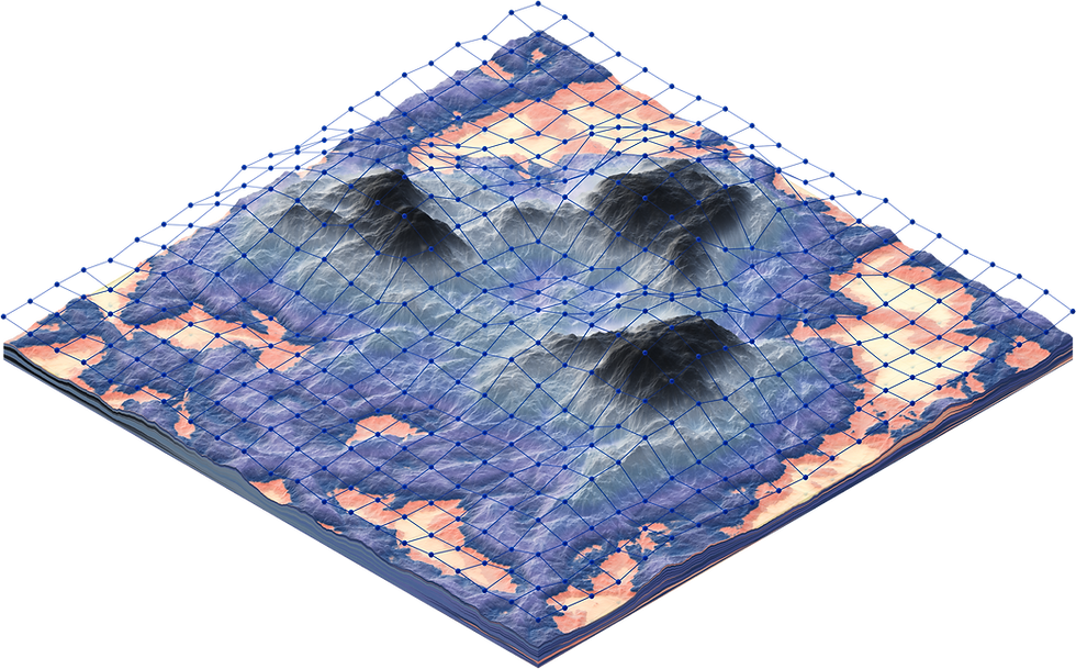
Establishing 1D and 2D hydraulic models by processing surveyed and terrain data into modelling software to quantify flow, velocity, hazard, and depth. We assess system performance and infrastructure to identify bottlenecks and capacity constraints, ensuring water moves safely through the environment.

Hydraulic modelling
04.
Groundwater modelling
Simulating subsurface water movement to understand water tables, seepage, and aquifer behavior. This is vital for managing water resources and planning construction dewatering in the Middle East and Africa, where groundwater is both a critical resource and a frequent project constraint.
Groundwater modelling

Data & Modelling

05.
Desktop studies
Masperplanning
Developing district or catchment wide stormwater and drainage strategies for large-scale developments. Whether supporting an expanding city or a new mega-project, we can model integrated, long-term flood and stormwater management frameworks that fit seamlessly into the broader vision.
06.
Stormwater design
Translating hydraulic model results into practical, buildable infrastructure. We provide detailed sizing and design for culverts, open channels, attenuation basins, and storm sewer networks, ensuring the built environment can handle predicted flows without unnecessary over-engineering.

Hydrological modelling
07.
Hazard mapping
Creating clear, actionable maps that show where water will go, how deep it will get, and how fast it will move during major storm events. We help developers and municipalities identify high-risk zones to protect communities, critical infrastructure, and future investments and identify mitigation solutions.

Hydraulic modelling
08.
Climate resilience
Future-proofing infrastructure against shifting weather patterns. We incorporate nature-based solutions, like SuDS and green infrastructure, and updated climate projections to ensure drainage networks in vulnerable regions remain robust for decades to come while protecting the environment.
Groundwater modelling

Planning & Design
09.
Custom tool and plugins
Building tailored scripts, GIS tools, and software plugins to automate repetitive tasks and process datasets efficiently. This allows our team and clients' to handle complex, large data and deliver precise results faster and more cost-effectively while reducing human error.

Hydrological modelling
Technical reviews
10.
Acting as an independent expert eye on third-party models, designs, and reports. We provide rigorous quality assurance, checking technical assumptions and model stability compliance to give clients complete confidence before they approve final investments.

Hydraulic modelling
Specialized Services





Our experts specialize in advanced H&H modelling and GIS technologies. From seamless data pre-processing to sophisticated post-processing analysis, we transform raw data into highly effective flood management and engineering solutions
Software capabilities
Software Capabilities
Our experts specialize in advanced H&H modelling and GIS technologies. From seamless data pre-processing to sophisticated post-processing analysis, we transform raw data into highly effective flood management and engineering solutions

Data & Modelling
01. Desktop studies
Gathering and analyzing historical data, topographical maps, and previous reports before proceeding to the more extensive stages.
We identify missing information and assess early risks; a critical first step if historical gauge data or localized terrain mapping can sometimes be sparse.
02. Hydrological modelling
Converting rainfall data into runoff estimates to understand how much water will flow through a catchment. We build models tailored to specific regional climates; from intense, sudden flash flooding in dry Middle Eastern wadis to heavy monsoon downpours in Pakistan to establish accurate baseline flows.
03. Hydraulic modelling
Establishing 1D and 2D hydraulic models by processing surveyed and terrain data into modelling software to quantify flow, velocity, hazard, and depth. We assess system performance and infrastructure to identify bottlenecks and capacity constraints, ensuring water moves safely through the environment.
04. Groundwater modelling
Simulating subsurface water movement to understand water tables, seepage, and aquifer behavior. This is vital for managing water resources and planning construction dewatering in the Middle East and Africa, where groundwater is both a critical resource and a frequent project constraint.
Planning & Design

05. Masterplanning
Gathering and analyzing historical data, topographical maps, and previous reports before proceeding to the more extensive stages.
We identify missing information and assess early risks; a critical first step if historical gauge data or localized terrain mapping can sometimes be sparse.

06. Stormwater design
Converting rainfall data into runoff estimates to understand how much water will flow through a catchment. We build models tailored to specific regional climates; from intense, sudden flash flooding in dry Middle Eastern wadis to heavy monsoon downpours in Pakistan to establish accurate baseline flows.
07. Hazard mapping
Establishing 1D and 2D hydraulic models by processing surveyed and terrain data into modelling software to quantify flow, velocity, hazard, and depth. We assess system performance and infrastructure to identify bottlenecks and capacity constraints, ensuring water moves safely through the environment.
08. Climate resilience
Simulating subsurface water movement to understand water tables, seepage, and aquifer behavior. This is vital for managing water resources and planning construction dewatering in the Middle East and Africa, where groundwater is both a critical resource and a frequent project constraint.
Specialized Services
09. Custom tools and plugins
Converting rainfall data into runoff estimates to understand how much water will flow through a catchment. We build models tailored to specific regional climates; from intense, sudden flash flooding in dry Middle Eastern wadis to heavy monsoon downpours in Pakistan to establish accurate baseline flows.

10. Technical reviews
Establishing 1D and 2D hydraulic models by processing surveyed and terrain data into modelling software to quantify flow, velocity, hazard, and depth. We assess system performance and infrastructure to identify bottlenecks and capacity constraints, ensuring water moves safely through the environment.